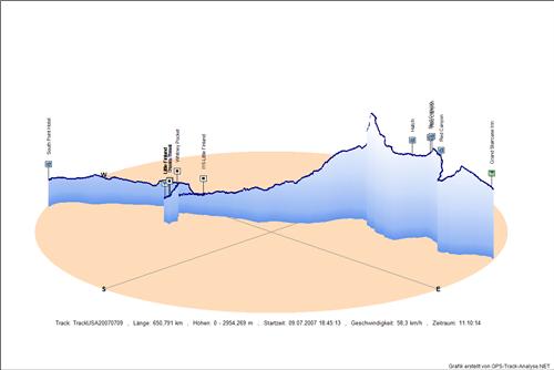
Track: USA20070709
Grand Staircase Inn - Red Canyon - Red Canyon - Red Canyon - Hatch - I15-Little Finland - Whitney Pocket - Devils Throat - Little Finland - Little Finland - Yucca Trees - South Point Hotel
Aufgezeichnet am
Streckenlänge
Minimale Höhe
Maximale Höhe
Zeitraum incl. Pausen09.07.2007 18:45:13
650,791 km
425,5 m
2954,3 m
11,17 h
This map was created using GPS Visualizer's do-it-yourself geographic utilities.
Please wait while the map data loads...
2D Höhenmodell
3D Höhenmodell
Downloads:
GPX - Datei gezipt
KMZ - Archiv für GoogleEarth
2D Höhenmodell in Originalgröße
3D Höhenmodell in Originalgröße

