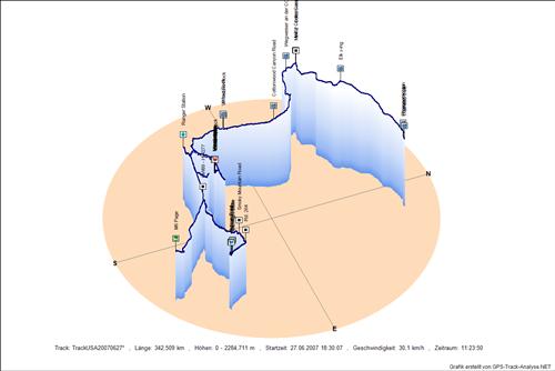
Track: USA20070627
Prospector Inn - Prospector Inn - Trailhead Cafe - Elk x-ing - HW12 - Cottonwood Canyon Road - Visitor Center Cannonville - Wegweiser an der CCR - Cottonwood Canyon Road - VP Yellow Rock - Yellow Rock - Ranger Station - Chimney Rock - 4 Gestalten - White Valley - White Valley - White Giant - White Valley - Hoodoos - Hoodoos - Hoodoos - HW89 - HW277 - Smoky Mountain Road - Rd. 264 - Gunsight Butte - Gunsight Butte - Alstrom Point - Alstrom Point - M6 Page
Aufgezeichnet am
Streckenlänge
Minimale Höhe
Maximale Höhe
Zeitraum incl. Pausen27.06.2007 18:30:07
342,509 km
1168,1 m
2284,7 m
11,40 h2D Höhenmodell
3D Höhenmodell
Downloads:
GPX - Datei gezipt
KMZ - Archiv für GoogleEarth
2D Höhenmodell in Originalgröße
3D Höhenmodell in Originalgröße

